About Me

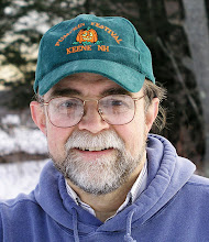
My photo
Spofford, New Hampshire, United States
Jeff Newcomer had been a physician practicing in New Hampshire and Vermont for over 30 years. Over that time, as a member of the Conservation Commission in his home of Chesterfield New Hampshire, he has used his photography to promote the protection and appreciation of the town's wild lands. In recent years he has been transitioning his focus from medicine to photography, writing and teaching. Jeff enjoys photographing throughout New England, but has concentrated on the Monadnock Region and southern Vermont and has had a long term artistic relationship with Mount Monadnock. He is a featured artist in a number of local galleries and his work is often seen in regional print, web publications and in business installations throughout the country. For years Jeff has published a calendar celebrating the beauty of The New England country-side in all seasons. All of the proceeds from his New England Reflections Calendar have gone to support the Pulmonary Rehabilitation Program at the Cheshire Medical Center. Jeff has a strong commitment to sharing his excitement about the special beauty of our region and publishes a blog about photography in New England.

Sunday, September 9, 2012

Geo Labeling with the iPhone


I am now firmly back in New England from my trip out west. I am still struggling to catch up, so this week, I wanted to briefly discuss something I learned while away.

Morning Window, West Chesterfield, NH
For a number of years I have been compulsive about recording the GPS coordinates of my photographs. As I have often said, "there are just too many red barns in New England for my old brain to keep them all straight". My usual work flow includes continuously recording my position with a separate GPS tracker and then, using the GeoSetter program to merge that data with my images back in the studio. This has worked beautifully as long as I keep the clocks on the tracker and my camera synchronized. The tracker is particularly important when I am exploring unfamiliar areas, so you can imagine my annoyance when I discovered on the first day of our recent stay in Yellowstone that the tracker was NOT tracking. I tired everything but I couldn't get the device to find me. After I resisted the urge to heave the useless chunk of plastic into the gaping maw of Old Faithful, I started looking for alternatives.

Steve Jobs to the Rescue

Koredoko App
Then I recalled that my sparkling new iPhone 4s automatically records GPS coordinates on every picture. A quick search at the App Store revealed "Koredoko", a little app that displays the GPS coordinates of each picture in the camera roll and, when connected to the net, also shows the location on a Google map. It was quick, simple and FREE. Before I got out of the cabin door, I was back in business. All I had to do was remember to grab an iPhone
picture for every new location. At the end of the day I opened the images in
GeoSetter and manually assigned the coordinates to the images. It was a little more cumbersome to type in the coordinates, but the
GeoTracker Batching
process could be batched so I only had to input once for each new location. Done! This was not as simple and elegant as synching the images with the tracker, but it worked. I will try to get the Tracker back working, perhaps it will do better now that it is in familiar territory, but it is nice to know that I have a workable backup.


Cascade Creek, Grand Tetons, Wyoming


Many but not all phone have GPS capability, but if yours does, you may want to consider using it to help find that old red barn for another shoot.
6 comments:

  1. Great Tips Jeff thank you. Another tip would be to use Google's map feature. After you activate the maps you press the locater button and you clicked on the star to remember the place where you are.

    ReplyDelete
  2. I have been using the new map feature in Lightroom 4 and this works only if you know where something was to begin with... I spent hours using Googles street view going up and down Route 100 to spot a particular red barn... Thanks for sharing.. I've also been using everytrail to track my driving and when I take my pictures I can merge them into the terrain map later.. But my camera clock has to be accurate... :-) can't get around that one...

    ReplyDelete
  3. In the phone/camera/ video market and this information is great, thanks I too would not remember locations of photos.

    ReplyDelete
  4. Thank you so much for giving everyone such a splendid opportunity to discover important secrets from this site.
    It is always very sweet and full of fun for me personally and my office colleagues to
    visit your blog minimum thrice in a week to see the fresh guidance you will have.
    And definitely, I'm so always amazed for the fabulous creative
    ideas served by you. Some two points in this posting are absolutely the most effective we've had.

    Visit my site :: 카지노커뮤니티

    (IVY)

    ReplyDelete
  5. Undeniably consider that which you stated. Your favorite reason seemed
    to be at the web the easiest thing to understand of. I say to you, I definitely get irked even as other folks consider concerns that they plainly don’t
    realize about. You controlled to hit the nail upon the highest and outlined out
    the entire thing with no need side-effects , folks could take a signal.
    Will likely be again to get more. Thanks오피월드


    2YOUNGYANG

    ReplyDelete
  6. Pretty useful article. I merely stumbled upon your internet site and wanted to say that I’ve very favored learning your weblog posts. Any signifies I’ll be subscribing with your feed and I hope you publish once additional soon. 메이저사이트
    dshh

    ReplyDelete