About Me

My photo
Spofford, New Hampshire, United States
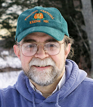
Jeff Newcomer had been a physician practicing in New Hampshire and Vermont for over 30 years. Over that time, as a member of the Conservation Commission in his home of Chesterfield New Hampshire, he has used his photography to promote the protection and appreciation of the town's wild lands. In recent years he has been transitioning his focus from medicine to photography, writing and teaching. Jeff enjoys photographing throughout New England, but has concentrated on the Monadnock Region and southern Vermont and has had a long term artistic relationship with Mount Monadnock. He is a featured artist in a number of local galleries and his work is often seen in regional print, web publications and in business installations throughout the country. For years Jeff has published a calendar celebrating the beauty of The New England country-side in all seasons. All of the proceeds from his New England Reflections Calendar have gone to support the Pulmonary Rehabilitation Program at the Cheshire Medical Center. Jeff has a strong commitment to sharing his excitement about the special beauty of our region and publishes a blog about photography in New England.
Showing posts with label Covered Bridge. Show all posts

Sunday, November 22, 2015

October Therapy : Autumn Glory, Part 1


Forest Pillars Chesterfield, NH


November Excitement
  

It is mid November and without any snow in sight I am in the middle of my usual November malaise. I know that, photographically, November provides the opportunity to focus on the intricate bare patterns and textures of the season. It is a great challenge to find things to shoot in the grip of this unrelenting gray "stick" time of year, but It is nevertheless all too easy to sink into despair.  When I finally run out of creative ways to make dead leaves and other lawn liter appear artistic, there is a blessed source of relief from this malady, October Therapy.


October Therapy
Madame Sherri's Arches, Chesterfield, NH


There is no greater contrast in the moods of our seasonal journey than that from October to November. We reveal in the brief riotous colors of the peak October foliage and then, almost overnight, the trampled earth jealously reaches up to claim the leaves. November is upon us, but we can still call forth the glory of October's brilliance.


Autumn Shadows, Westmoreland, NH


October is always a frantic time, trying to get out to capture the autumn colors at there best. With luck, the result is a pile of RAW images begging to be processed to there full warmth and brilliance. In November I warm the cold damp weather with a fire in the stove and with the opportunity to immerse myself in the images of fall's spectacle.


Two in Pasture, Walpole, NH


A Very Good Season

 
Wind Vane, Chesterfield, NH


This year's foliage seemed more brilliant and long lasting than during many recent seasons. After the fact, It is seems easy to explain the character of each fall season.  Perhaps the richness of this year's color was related to the warm dry summer.  This autumn's longevity was likely related to the lack of major rain and wind driven storms.  For me each fall is a mysterious surprise and my goal is always the same, to get out to shoot as often as I can, in as many conditions of light and weather as possible. 


This year the range of my explorations were more limited than usual. I found myself tied to home by a list of projects and demands including my digital photography class at Keene Community Education, the Columbus weekend Fall Foliage Studio Art Tour and a couple of lovely trips to New England's southern coast. Happily there was plenty of color nearby in my local region and, as the last leaves gave up their struggle, I was left with my usual pile of images begging for attention.

Roadside Ferns, Chesterfield, NH

Dealing with the Pile

Holding On, Guilford, Vt


As I process this year's color, I have tried to be more organized than usual. It is always tempting to jump around my collection of images, latching on to whichever picture grabs my attention, but I am trying to work through the images in a more chronological order. Lightroom is a great help, allowing me to identify and label each set of images and then flag the most promising for closer attention.  


Feathery Retreat, Weathersfield, Vt


 In this weeks article/album I concentrate on images from the first half of October. In the Monadnock Region peak color tends to occur in the middle of October, around the Columbus Day weekend and a division of the month down the middle results in a fair distribution of the color.  There are limits to how many images I can show in one or two blog articles and I am dealing with that frustration by placing more pictures from the season in an Autumn 2016 Gallery on my web site.


Explorations

Downers Bridge, Weathersfield, Vt   


Perkinsville Green
In early October I headed north to look for the best color, before it descended closer to home. One of my favorite route is up Route 106 from Springfield Vermont wandering through Perkinsville, Weathersfield and Reading. In a short distance is found the Perkinsville Community Church with it compact green, the Downer Covered Bridge over the Black River and of course the Jenne Farm.  Reading is famous for the classic and over popular Jenne Farm but the town
Jenne Farm, Reading Vt
has many other attractions which do not require a fight with fifty other photographers to find a place for your tripod. On the opposite side of 106 up Caper Hill Road is the Springbrook Farm. Along the road are lovely pastures, one of my favorite birch groves and a classic sugar shack. On the top is a view to Mount Ascutney.  If you find it absolutely necessary, some of the pastures open to a vista across the valley back to the over photographed Jenne Farm. Route 106 continues north through beautiful countryside to Woodstock, but on this day I had to head home and responsibilities.


Black River cascade, Weathersfield, Vt

Close to Home

Chesterfield, NH
The countryside around our home in the southwest New Hampshire is resplendent in classic rural New England charm. No towering mountains or large masses of water, but soft rolling hills, snuggly settled farms and calm restful lakes that perfectly accent the warm tones of our New England autumn. Even our isolated Mount Monadnock has a settled inviting feel that compliments the surrounding, rather than dominating the bucolic settings.

Fencing the Color, Dublin, NH


Leading up to the Columbus Day weekend the color was building and I was able to find plenty of early and mid-season foliage within easy range of home. I hit many of my favorite locations Chesterfield, Westmoreland and Keene, including the Roads End and Hubner Farms, the Madame Sherri Forest, Spofford Lake, and the Poocham Road.


Roads End Bend, Chesterfield, NH


Class Work
Flight Risk Keene, NH
By the middle of the month I was finishing up my Basics of Digital
Photography Class. One the best parts of the course was the chance to bring the students out for a couple of shoots. The first was at Ashuelot River Park in Keene NH and the second was around Keene's classic Central Square. The conditions were challenging in the center of Keene, but that provided some important teaching opportunities. My friend and great photographer, Steve Hooper was kind enough to help out on my field trips. At the same time, Steve was teaching his own advanced landscape photography course at Keene State College's Cheshire Academy for Lifelong Learning, and I had the chance to reciprocate by joining one of his shoots in a wetland area around the Ashuelot River.


Ashuelot Floaters, Keene, NH

More Color to Come

Eden Run Autumn, Dublin, N\H


By mid and late October we saw more beautiful color, especially around the Monadnock Region and southern Vermont. I'm still working my way through many of those images and will save them for the second part of my October Gallery posting. In the meantime I will be uploading many more images to the Autumn 2016 Gallery on my web site.   Now get back to work on your Autumn images and if you get tired you can always go outside and take some more pictures of dead leaves and twigs!
Barn at the Bend, Keene, NH

Saturday, October 26, 2013

Everything New England in One Place

 
Green River, Guilford, Vermont
Despite years of exploring the New England landscape, I am still surprised by the rich variety of photographic opportunities.  There is always something new that I had never seen before.  I know that the new stuff was always their, but the "seeing" part takes time, with differing seasons and the constantly evolving light.


Green River Timber Crib Dam and Falls
  As much as I search for new scenes and perspectives, there are a few iconic New England subjects that are too classic to ever grow old and they always seem to pop up in my photography.  For me, a partial list of these icons would have to include: waterfalls, covered bridges, white churches, babbling brooks, red barns and inviting country inns.  Wonderful examples of all of these classics are liberally scattered throughout New England, but I know of one place where they can all be seen in one place and without even shuffling your feet. That magical place is Green River in Guilford, Vermont.


The Green River tumbles its way through Guilford in the southeast corner of Vermont.  About 2.5 miles southwest of Guilford Center,  the Jacksonville Stage Road crosses the river on a classic old covered bridge.  The bridge is the focal point of Green River Village, which is quintessential New England.  I try not to use the word “quintessential” more than once or twice a year, but Green River combines all the iconic New England elements in a lovely, undeveloped setting, what other word could I use ?


From one spot overlooking the bridge you can absorb the beauty of the 1838 Green River Church, the Green River Bridge House B&B, a lovely red barn on the hill, and the Green River Falls as it tumbles over an unusual timber crib dam.  Both the bridge and the dam are on the  National Registry of Historic Sites. . And did I mention that all the roads are dirt, not a single yellow line to spoil the mood.  the village is much more than a collection of individual attractions, but each deserves a brief mention.


Green River Covered Bridge
The Green River Bridge was built in 1873 and is 104 feet long.  For more than a century the bridge has been a key part of the little community.  In the past, the village mailboxes lined the walls. They're gone now, but there is still a nice view of the falls through the trusses, and it is still a great place to steal a kiss from your honey without all the neighbors knowing.  A sign above the bridge warns that you will risk a two dollar fine if you cross faster than a walk, but don't worry, everything about Green River says "slow down and relax".


Green River Timber Crib Dam and Falls
Timber Crib Dam
The recently restored timber crib dam is a fascinatingly intricate structure.  The wooden beams can be studied through the cascading water, but there is also a place where you can pass through the falls to stand behind the tumbling water.  The falls and the pool beneath provides a lovely spot to escape the summer heat.


Under the Falls


Green River Bridge House

Green River Bridge House
The Green River Bridge is a lovely B&B.  Built in 1830, the house has always been an  integral part of the village, including having housed the local post office.   The House offers three uniquely decorated guest rooms, which complement the warm and friendly atmosphere.  The grounds parallel the Green River providing unique perspective on the bridge, just up stream.


There Must be a Red Barn


The Red Barn
Beyond the bridge and just up a hill is a lovely farm house and our necessary roadside red barn.


Green River Church


Green River Church
Of course the scene would be incomplete without a village church.  Built in 1838,  The Green River Church is a classic New England house of worship, strong, sparse and relentlessly white.  It sits on a small hill overlooking and  tirelessly  guarding the village.


It is unique to find all these New England icons clustered in one small area, but what is truly remarkable is how they all work together.  The place is a compositional playground for photographers, with endless opportunities to combine the features into perfectly balanced images that scream "New England".  No matter how many times I return to Green River, I always find new ways to mix the changing seasons, the light and the icons to capture everything from grand landscapes to fascinating details.  Come by and check it out.  It is not easy to find, but well worth a wander off the beaten path.


Location:
To reach Green River take exit 1 off of I 91 in Brattleboro, Vermont.  Travel about 1.4 miles south on US5 to Guilford then take the right toward Guilford Center for about 4.1 miles to the little Center.  Shortly after the "Center" take a right on Stage Road.  Travel 2.4 miles to the bridge.

When you finally acknowledge that you are lost, try the GPS Coordinates:
Latitude.        N 42 46.532
Longitude      W 72 40.015
Sunday, May 5, 2013

Blow-Me-Down Mill, A Welcome Photo Assignment

Blow-Me-Down Mill


Blow-Me-Down Mill in Cornish, New Hampshire is a lovely place to photograph, but what’s with the name?

I love an assignment so when Cam Mirisola, Senior Editor for New Hampshire To-Do Magazine emailed me last week about a project

Aspet House, Saint Gaudens,
Cornish, NH
for an up-coming edition, I got excited. Cam was looking for images of Cornish New Hampshire, specifically, any showing the beautiful Saint Gaudens Historic Site in the spring. I was a little disappointed that I already had pictures of the site which seemed to satisfy her request from a couple of years ago, but she also mentioned a location that was entirely new to me. At once I knew I had my assignment.
Saint Gaudens Retreat Blog

Cornish-Windsor Covered Bridge
The next day I got up early to search Cornish for the intriguingly named “Blow-Me-Down Mill”. Of course I first Goggled the mill and learned that it was now part of the Saint Gaudens National Historic Site. In the morning I cruised up Route 12a along the Connecticut

Cornish-Winsor Bridge, Mount Ascutney
River stopping at the Cornish-Windsor Covered Bridge. The bridge was completed in 1866 and spans the Connecticut between Cornish New Hampshire and Windsor, Vermont. At 449 feet, it was the longest covered bridge in the country, until 2008 when a new concrete piered bridge was opened in Ohio. Really, 2008, Concrete, Ohio? Should that count? Anyway, the Cornish-Windsor Bridge still has the longest single span that carries vehicular traffic. On Monday morning, the sky was overcast, but I always find it difficult to pass by without grabbing a few shots with Mount Ascutney in the background.

The Cornish Art Colony
My initial directions to the mill were unnecessarily vague and sent me

Cornish Colony & Mill
off along the back roads of Cornish. After a lovely exploration, I eventually circled around and found the site, right on Route 12a, just few hundred yards north of the main entrance to Saint Gaudens. There had been a mill on this site dating back to the 1820’s, but the current structure was built on the direction of Charles Beaman in 1891. Beaman, a wealthy lawyer from New York City, had built his summer retreat in Cornish in the 1880’s and was instrumental in enticing the famous sculptor August Saint-Gaudens to build his summer home and studios nearby. Saint Gaudens was one
of the founders of the Cornish Art Colony. The Colony was renowned as a seasonal gathering place for a remarkably varied group of prominent artists of the time, including painters, sculptors, writers and actors. The Blow-Me-Down Mill was used by the community as a grist mill until its close in 1920, Now, only the restored building remains, along with a nice mill pond/wet land and a water fall.

Working the Mill
The day remained mostly overcast with only early hints of spring
foliage, but the area provided a wealth of interesting angles and I had a great time exploring the various options. My first challenge was to find a place to park the car that wouldn’t intrude on the pictures.  Despite my efforts, I still had to relocate as I moved around the site. The waterfall had good flow, and with the overcast sky, I was able to get a nice soft effect with only my polarizer and f22, but I also pulled out my variable neutral density filter to extend the exposure over several second. The compositional challenge was to find angles that included a nice balance of the mill building and the falls. From the side the building was rather flat and one dimensional so I moved down stream for better
perspective. During the summer and fall with the trees in full foliage views up the brook to the mill house would be obstructed, but on this
Four Second Exposure with Variable ND Filter
day, I was able to get a clearer look. The scene taken from the Stone
Bridge offered an especially nice perspective on the whole site. Along the edge of the brook, I used my trusty Mini Bungee Cords to pull back branches and, unlike most times, I actually remembered to retrieve the cords when I was done. In most compositions, I tried to minimize the dull sky, but I was able to bring out some of the texture in post using highlight 
adjustments.

Downstream with Bungee Assist


Stone Bridge/Tunnel


Stone 'Bridge"/Tunnel HDR
Downstream from the mill is an impressive stone bridge that, with the movement of the road, is now more of a tunnel. With the bright outside and dark tunnel, it was an excellent chance to apply a little HDR. In my picture I used 7 images. It was interesting how the small water drains lit up along the passage. They looked rather strange, but I decided to leave them in.


Blow-Me-Down Covered Bridge


Blow-Me-Dow Bridge over
Blow-Me Down Brook
My “assignment “ complete, I went on to explore the Blow-Me-Down Covered Bridge, which, not surprisingly crosses the Blow-Me-Down
Brook. Seriously?!  Is everything "Blow-Me Down" in Cornish?  The bridge itself was not especially unique, but then I move off to the side and discovered that it spans a spectacular little gorge("Blow-Me-Down Gorge I presume). I could have spent much more time here, but I had to get back to town. 

All-in-all it was a productive morning given the weather and the scant early spring foliage. As always I have this place recorded in my brain and in my GPS. I will return. Whether or not something gets in New Hampshire To-Do, I still have to thank Cam for a great tip and a good excuse to get away from the endless spring chores at home.


Oh, and the name. From what I read Saint Gaudens himself picked “Blow-Me-Down” as a joke. I’m not sure about that, but it is as good an explanation as any.

 Blow-Me-Down Mill:
 43° 29' 49.806" N
 72° 22' 32.544" W


Sunday, February 24, 2013

Photographic Treasures of Dummerston, Vermont


Spring Sunset, Dummerston, Vermont

Living in Chesterfield New Hampshire, I am fortunate to have easy access both to New Hampshire's Monadnock Region and southern Vermont. There has been much written about the differences between Vermont and New Hampshire. Vermont has the reputation as a softer, rolling countryside while New Hampshire is know for its more dramatic and craggy mountains. Clearly these are silly distinctions, more related to marketing than reality, but there are subtle differences, more in feel than geography. I would be hard pressed to put that difference into words, but I'm just happy to be able to sample both on an easy basis. 


When I head out on a shoot my first decision comes at the end of the driveway where I must choose to turn left for New Hampshire or right for Vermont. It is an interesting choice since traditionally the political directions of the states have been the opposite. It is well understood that the progressive regions of New Hampshire are those that touch Vermont and that is fine for me. As I cross the Connecticut River into Vermont one of my favorite nearby places to explore is Dummerston and this week I would like to highlight some of the best photographic attractions of this lovely and peaceful slice of classic Vermont landscape.


Dummerston, Vermont
Dummerston lies just across the Connecticut River from Chesterfield,

Dummerston Back Road
New Hampshire. It is just north of Brattleboro but offers a quick and complete escape from that bustling town. It's 30.8 square miles feature rolling farm land and several classic New England villages. In addition to the Connecticut River on the east, it
Hay Rake Mist
is bisected by the West River, which in earlier times was a source of power for a number of mills. Now the river is a source of beauty and, in the summer, a favorite spot for tubing and white water kayaking. Dummerston has many lovely back roads, excellent for getting lost. There are wonderful photographic opportunities around every turn, but I definitely have my favorites. 


1) Dummerston Covered Bridge
Dummerston Covered Bridge
The 270 foot long Dummerston Bridge is the longest covered bridge still carrying traffic in Vermont. The bridge was built in 1872 to span the West River and offers numerous interesting perspectives. My favorite location has always been from downstream, looking back on the bridge with the hills in the distance, but I keep coming back to find fresh inspiration. 


2) Black Mountain
Just downstream from the covered bridge Black Mountain rises dramatically above the north bank of the river and is part of the 593

Pitch Pine on Black Mountain Summit
acre Black Mountain Conservation Area. The 1280 foot summit can be accessed from Rice Farm Road on the east side of the West River, but a much easier trail starts on the other side of the mountain off Black Mountain Road. This trail winds about 1 mile through a peaceful and varied woodland and provides a lot of reward for modest effort. The summit is well worth the short walk, providing lovely views along the Connecticut River Valley and east to distant Mount Monadnock. The rock outcroppings at the top provide great places for rest and contemplation, so be sure to bring a snack. Also notice the Scrub Oak and Pitch Pine trees around the summit. Both are quite rare in Vermont. 


3) Stickney Brook Falls
One of my favorite nearby cascades is along Stickney Brook just
before it reaches the West River. The area features a series of short falls and cascades as the brook tumbles past the location of a old mill site. The intensity of the falls vary greatly depending on the weather and supply of water. It is especially exciting during spring run-off or any time after a heavy rain. During the summer, the Brook's pools are a popular refuge from the heat. The falls are easy to find on Stickney Brook Road off of route 30. 


Stickney Falls


Orchards
Scott Farm Orchard & Mt Wantastiquet

Dwight Miller Orchard
Dummerston offers a number of beautiful orchards featuring an wide variety of apples and other native fruits. They also provide beautiful vistas for photography throughout the year, but especially during the brief spring blossom season. Dwight Miller and Sons Orchard (4) is located in East Dummerston. A drive up Miller Rd reveals long views to the north and east with a foreground
Connecticut River from Scott Farm
dominated by the hilltop orchard. In addition to their certified organic apples & cider, they feature peaches, pears, blueberries, and strawberries. The Scott Farm (5)is known for its wide variety of rare antique apple varieties. The orchard is on a hillside with dramatic views of the Connecticut River Valley and Mount Wantasiquet. In addition to great produce the farm is host to weddings and other events. I have attended a couple of weddings on the hillside and I can testify that the location is breathtaking. 

Scott Farm Rainbow
Orchard Vows


6) Walker Farm
In season drop by Walker Farm on Route 5.  The farm well deserves its ranking as one of Yankee Magazine's top 5 Nurseries and Garden Centers in New England.  The farm stand is always packed with the best 
seasonal fruits and vegetables, but my favorite is the extensive green houses, whose colorful flowers provide a desperately needed splash of spring just when I need it most.  I've talked before about using the greenhouses to cheat with my flower photography.  Within the shelter the blooms are always softly lit and there is no wind to smear my long exposures.  The staff is always helpful. Just be sure your tripod doesn't trip the customers!


7) Rudyard Kipling
Dummerston is also the location of "Naulakha" , Rudyard Kipling's

Naulakha
country home, where he wrote the Jungle Books and Captains Courageous. It is also where he invented Snow Golf. In the winters of the 1890's Kipling challenged guest to hit red painted golf balls into red cups that had been placed in the snow around the property. The game offered special challenges especially since a drive could occasionally skitter two mile down the icy slopes  into the Connecticut River.


Dawn Pasture, Dummerston
Dummerston has many special locations, but for me the greatest attraction is that a peaceful meander along the town's back roads almost always yields something new and classically New England.  The town is like many in New England, but  for me its proximity makes it easy to cruise by whenever I have an hour or two to explore. Most New Englanders have their own nearby treasures. With regular visits in all seasons and weather you will be  surprised how much beauty you can find in your own special corner of our unique region.